The progression of development creates a timeline of the land. The first map is a depiction of what Virginia Highlands looked like in the late 1800’s 20 years later Virginia Highlands was being developed and sold into lots. With this development came surveyors and this is what I would call the original survey for Adair Park. Every survey that is done in the subdivision of Adair Park is an attempt to retrace what J.C. Conn laid out in 1916. Attached below is a newspaper clipping that was in the folder of Mr. Conn’s files on Land Lot 1 of the 17 land District of Fulton County. This context in history is helpful. Note the trolley lines are in the center of the road and North Highlands Avenue is not paved.
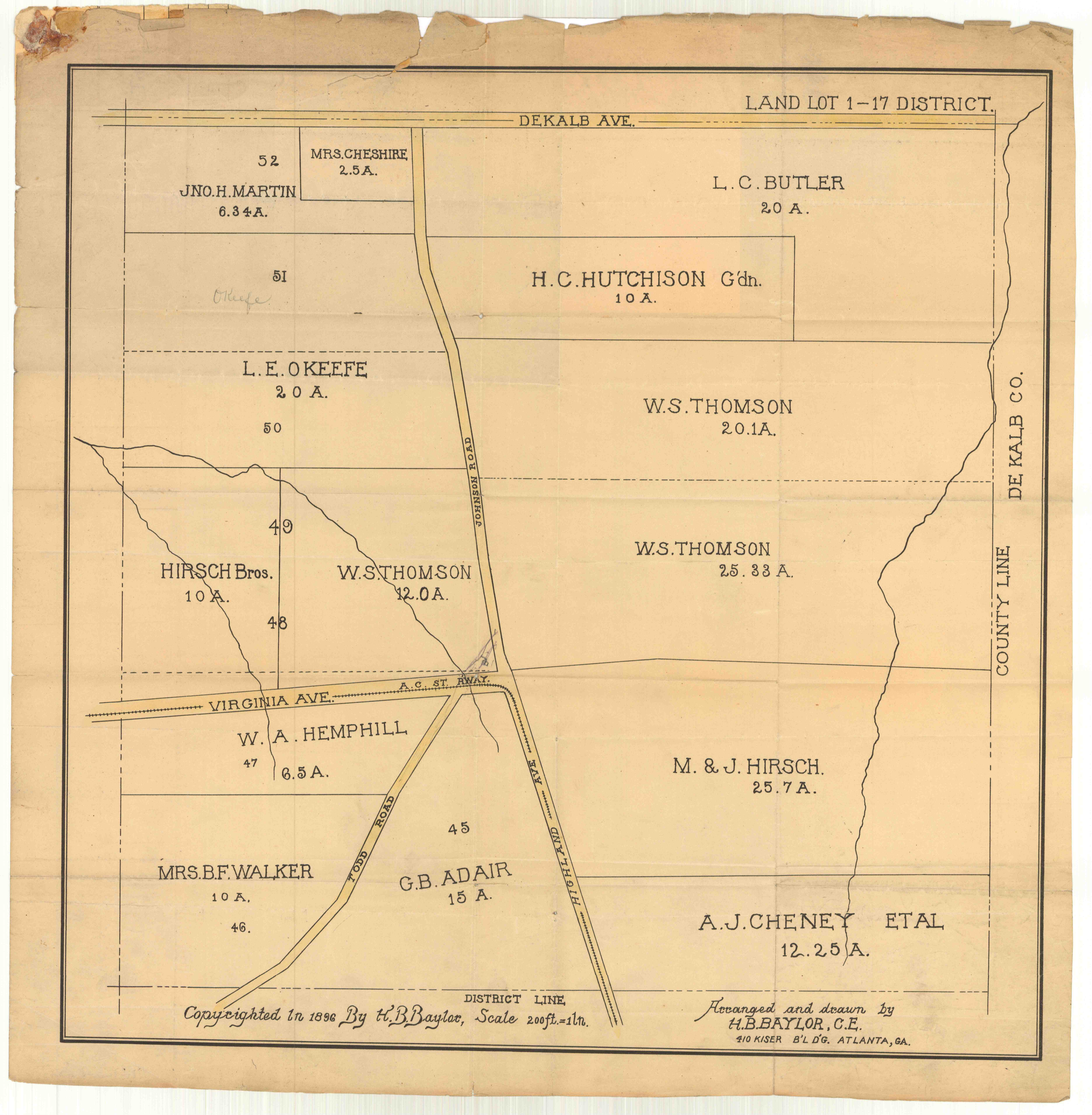
Virgina Highlands 1896
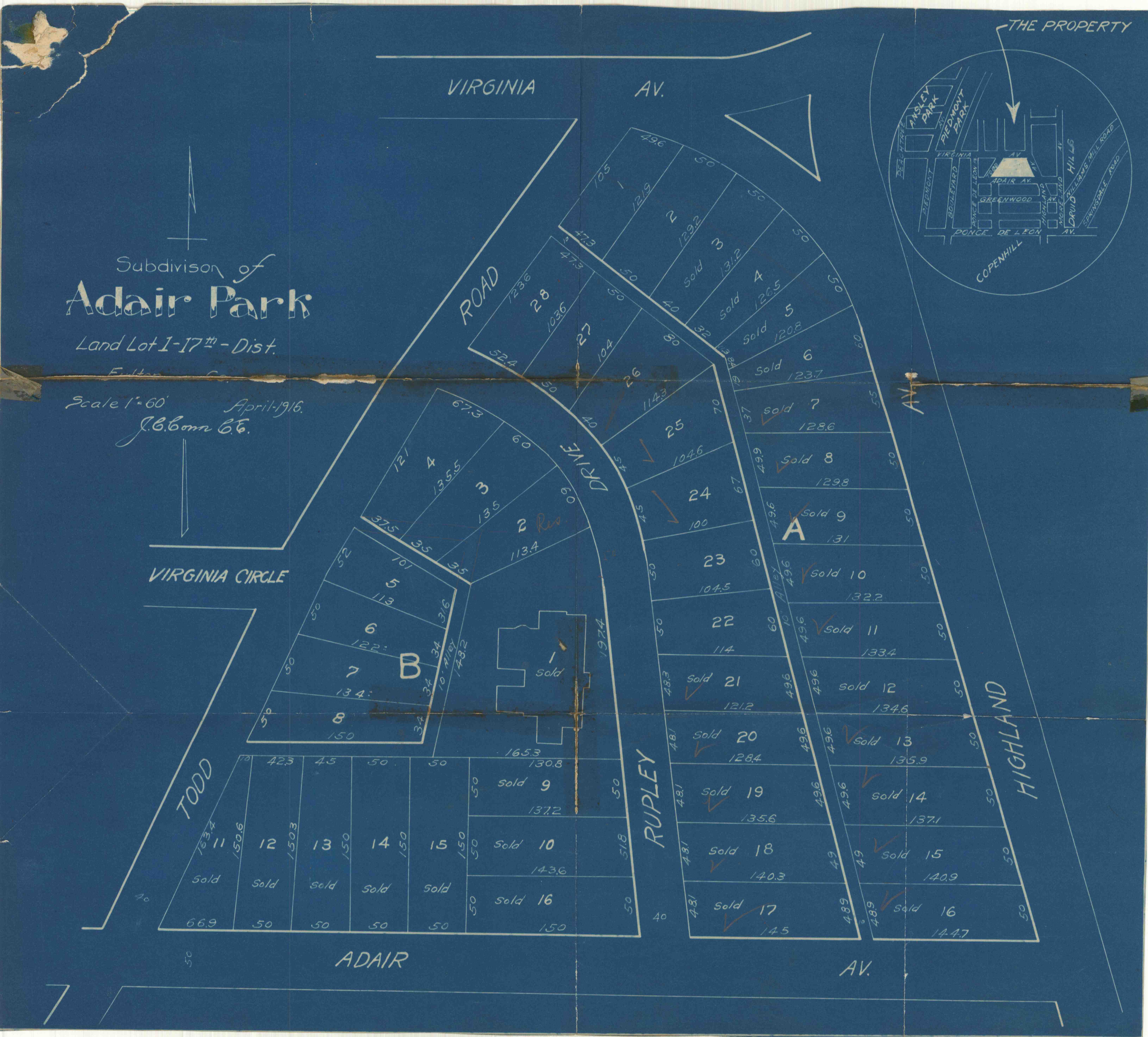
Virgina Highlands 1916
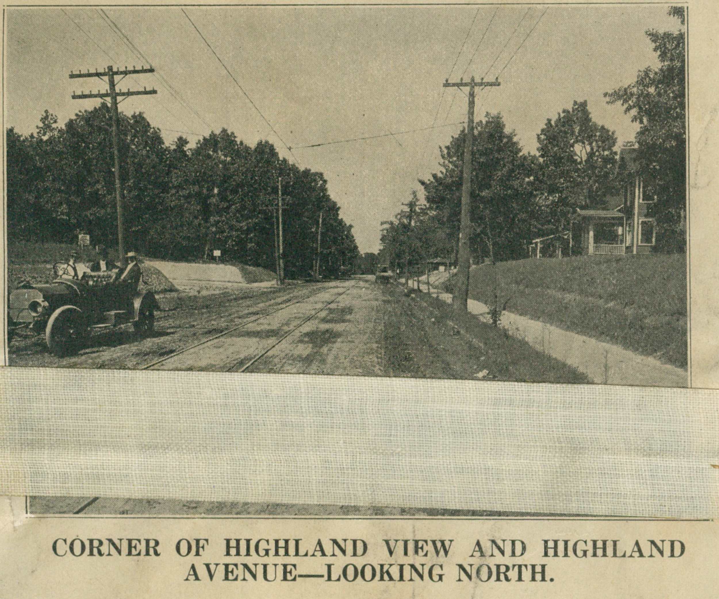
Virgina Highlands 1915