Occasionally when having a topographic survey done for your property, you need more specific and detailed information about the trees on your land. Georgia Land Surveying can provide this additional information with a topographic survey with tree location (sometimes also called a tree location survey).
WHEN DO YOU NEED A TOPOGRAPHIC/TREE LOCATION SURVEY?
Here are some instances in which you’ll want more detailed information about how many trees are on your property, and where they are located:
- If you are planning a building project and need to know which trees to keep and which to remove
- To comply with local ordinances or HOA covenants about the number of trees on your land, and/or whether any can/should be removed
- To clarify with a neighbor as to who owns a tree near your property boundary
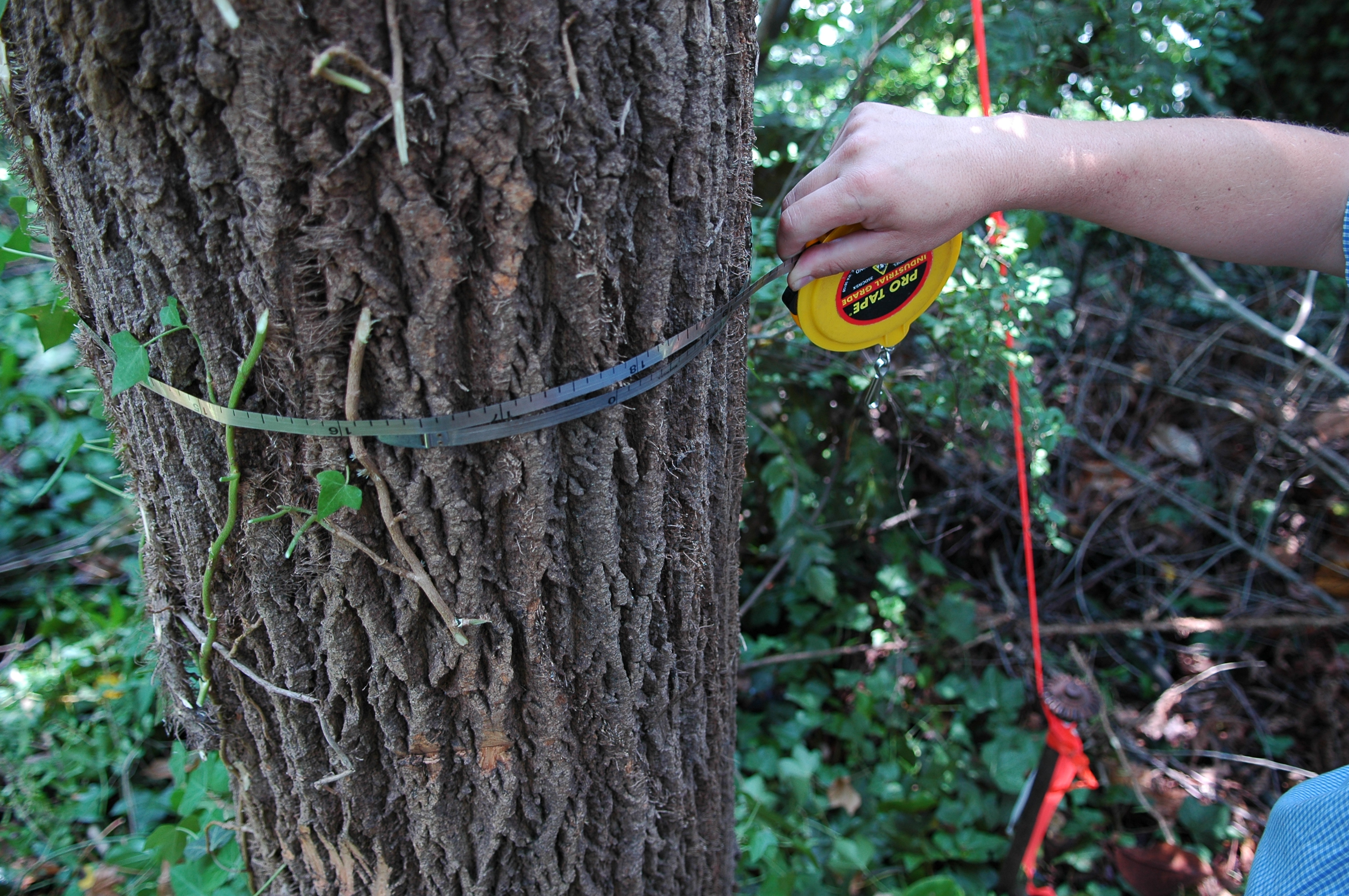
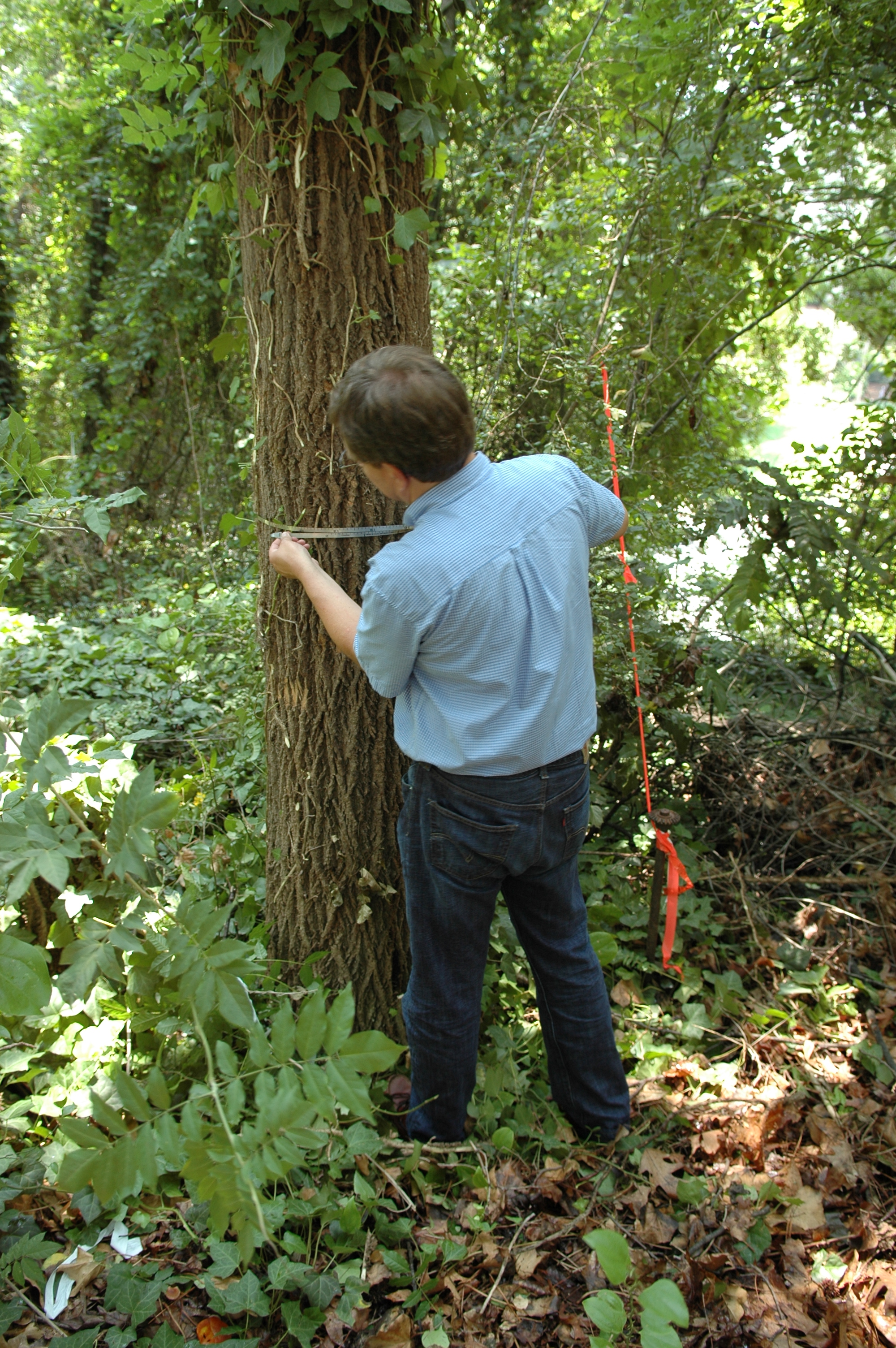
- To have an inventory of the trees on your land and their density, for forestry preservation, runoff management, or in compliance with local rules and regulations. Most jurisdictions require information about the location of trees with a 6” DBH (diameter at breast height) and above.
CONSIDERATIONS FOR A TOPOGRAPHIC SURVEY WITH TREE LOCATION
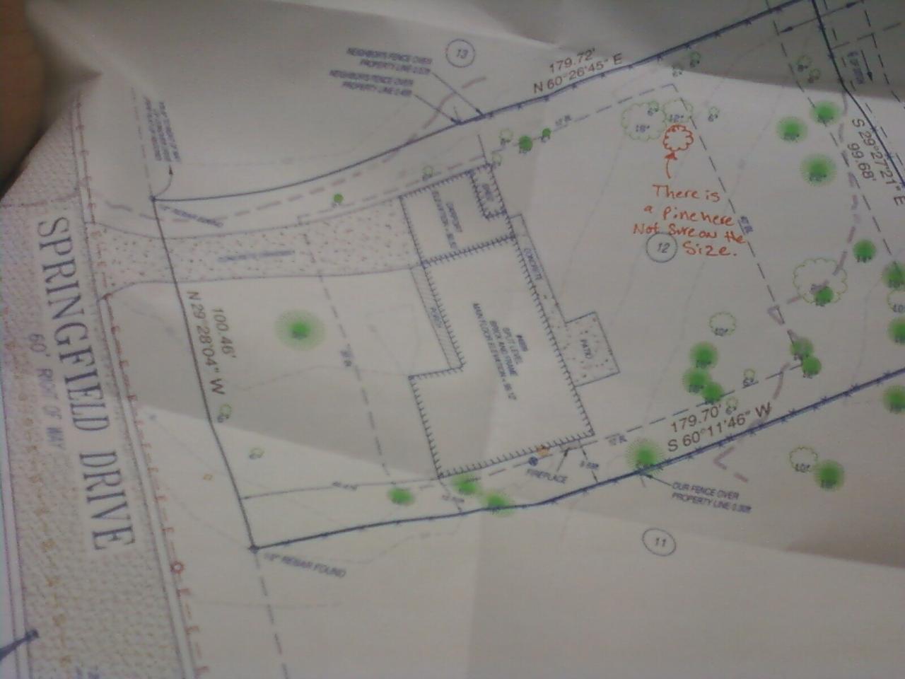
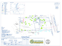
In addition to our standard topographic survey, Georgia Land Surveying will provide detailed information about the number of trees on your property, measuring their dimensions and plotting their locations. As required by local jurisdictions, we may also provide information about the species of trees on your property.
For more information about topographic surveys with tree location and instances in which you may need this information, contact Georgia Land Surveying today.