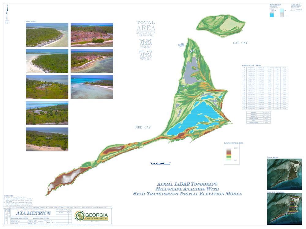
Topographic Survey of Bird and Cat Cay in the Bahamas.
Company News
Why Your Surveyor Should Be Using LiDAR
By Josh Lewis
How many times have you been in the middle of permitting a project when it gets put on hold because the municipality needs more information? Maybe they want to know if the specimen tree on the neighbor’s property is going to be impacted by the development, or perhaps they want to determine flood elevations for the stream going through the site, or maybe they need a “distance survey” for a site.
If your surveyor used LiDAR to generate your plans, then you’re in luck. The data is already in the can. The surveyor’s CAD department can update the survey and issue a revision, typically within 24 hours. That’s because when the survey is prepared using LiDAR technology, all that information (and much more) is captured.
How UAVs Are Changing Landfill Surveying
By Bradley Kruse
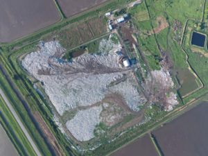 Effective landfill management is essential to the quality of life in today’s modern society. There are a number key issues that concern landfills, including public health, environment, political and local economics. According to the EPA, the United States has generated an estimated 258 million tons of municipal solid waste in 2014, and that figure continues to rise to this day.
Because the increasing generation of municipal solid waste has nearly doubled since 1975, landfill management professionals are exploring all possible options to improve the efficiency of land use. Unmanned Aerial Vehicles, or UAVs for short, are proving to be an effective tool during that process.